BARCLAY TERRACE, EDINBURGH
Public Realm designed to create a pedestrianized street in front of a Victorian tenement building with shops at ground level opening onto the new space. An attractive, accessible and active street connecting to parkland with views to the city and Arthur’s Seat.
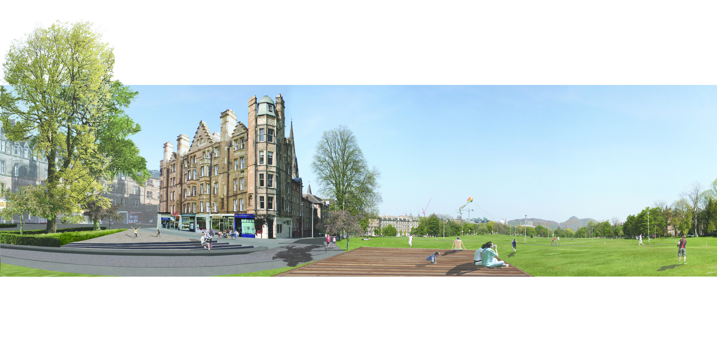
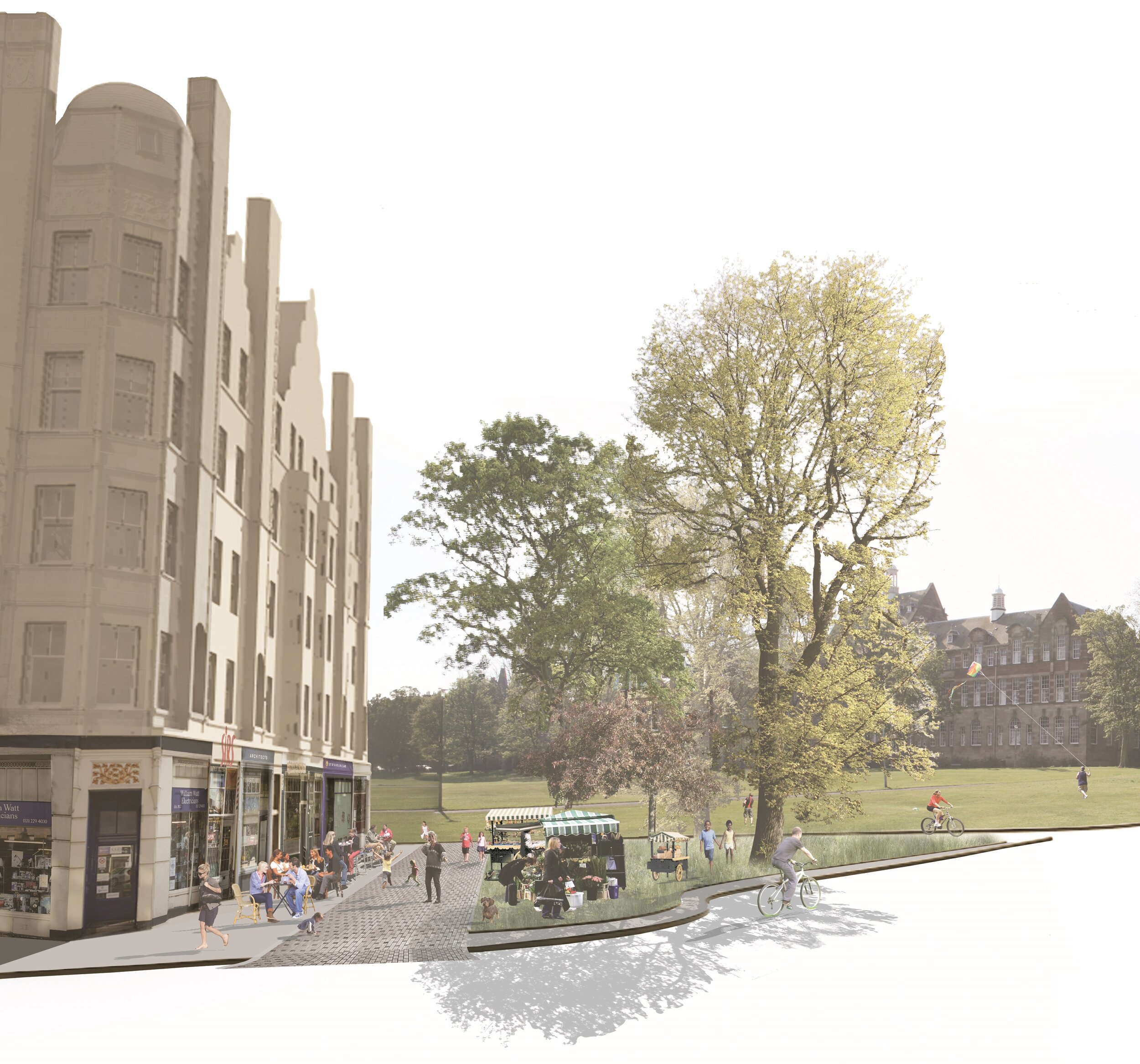
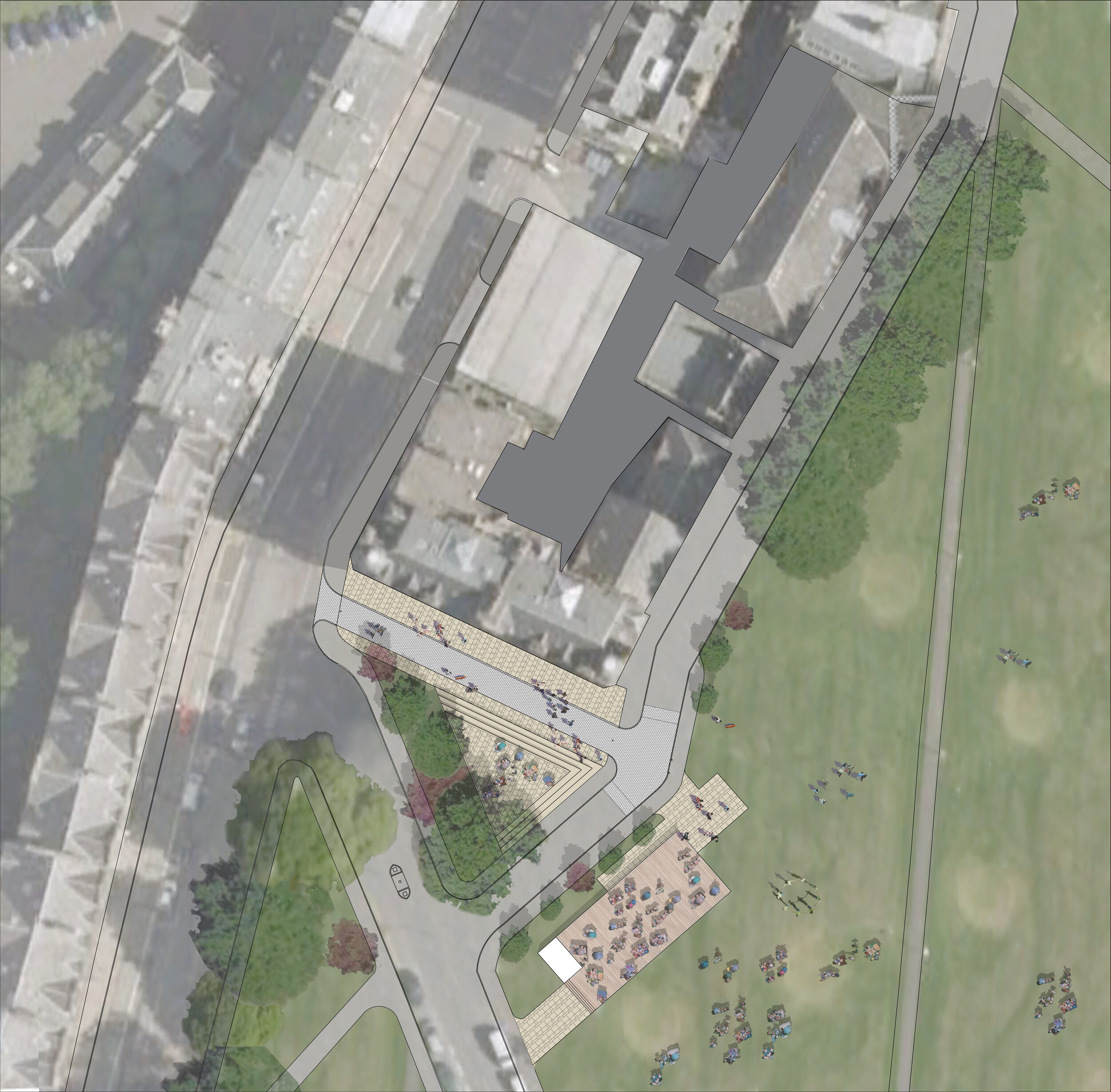
Architect: Matson Henderson Architects
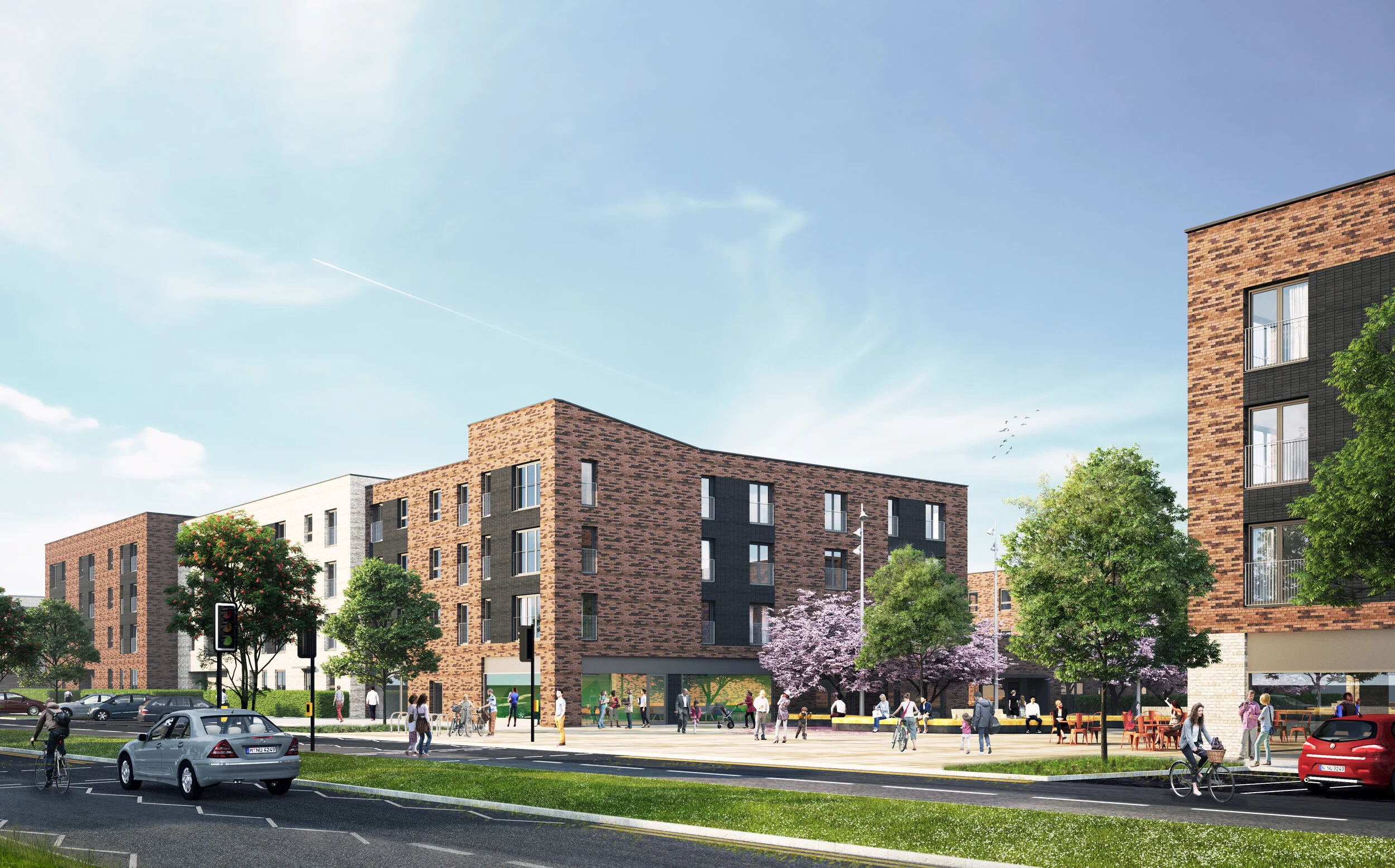
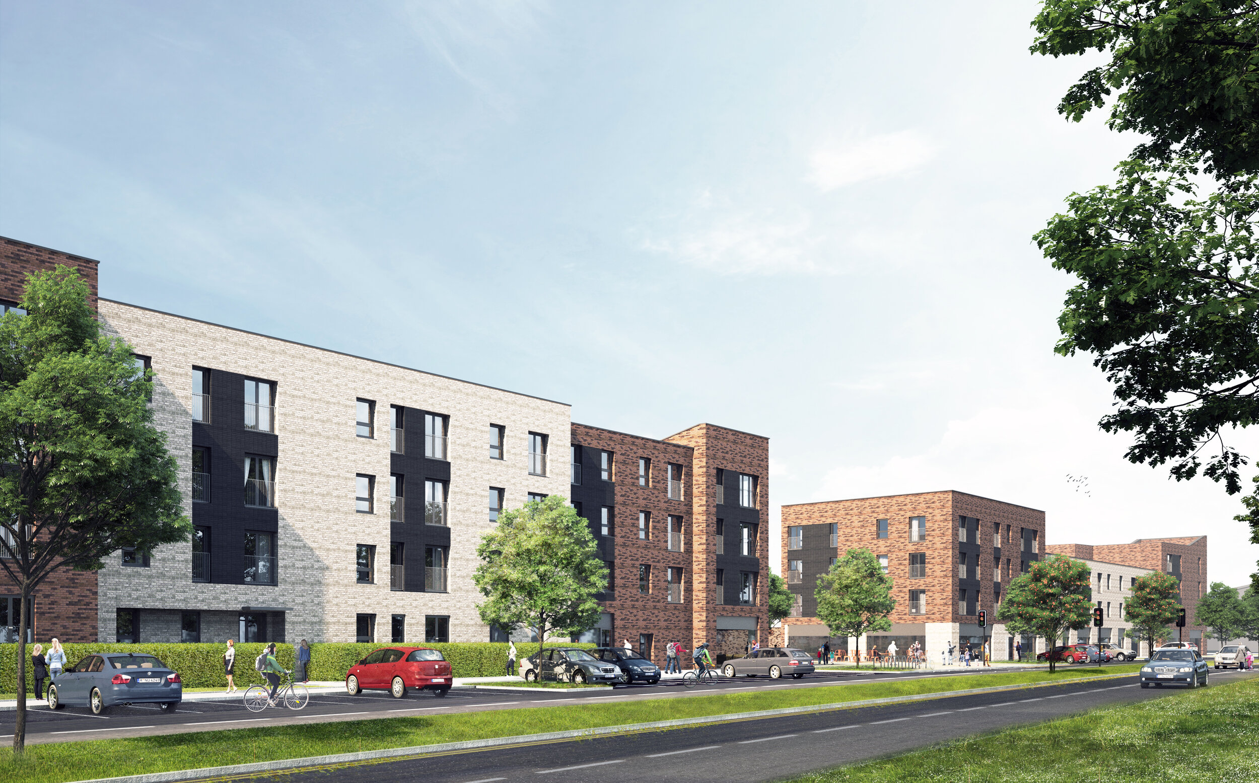
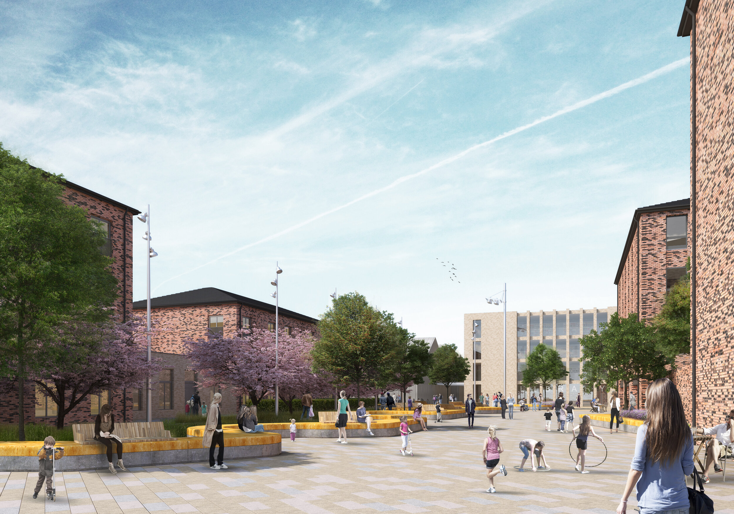
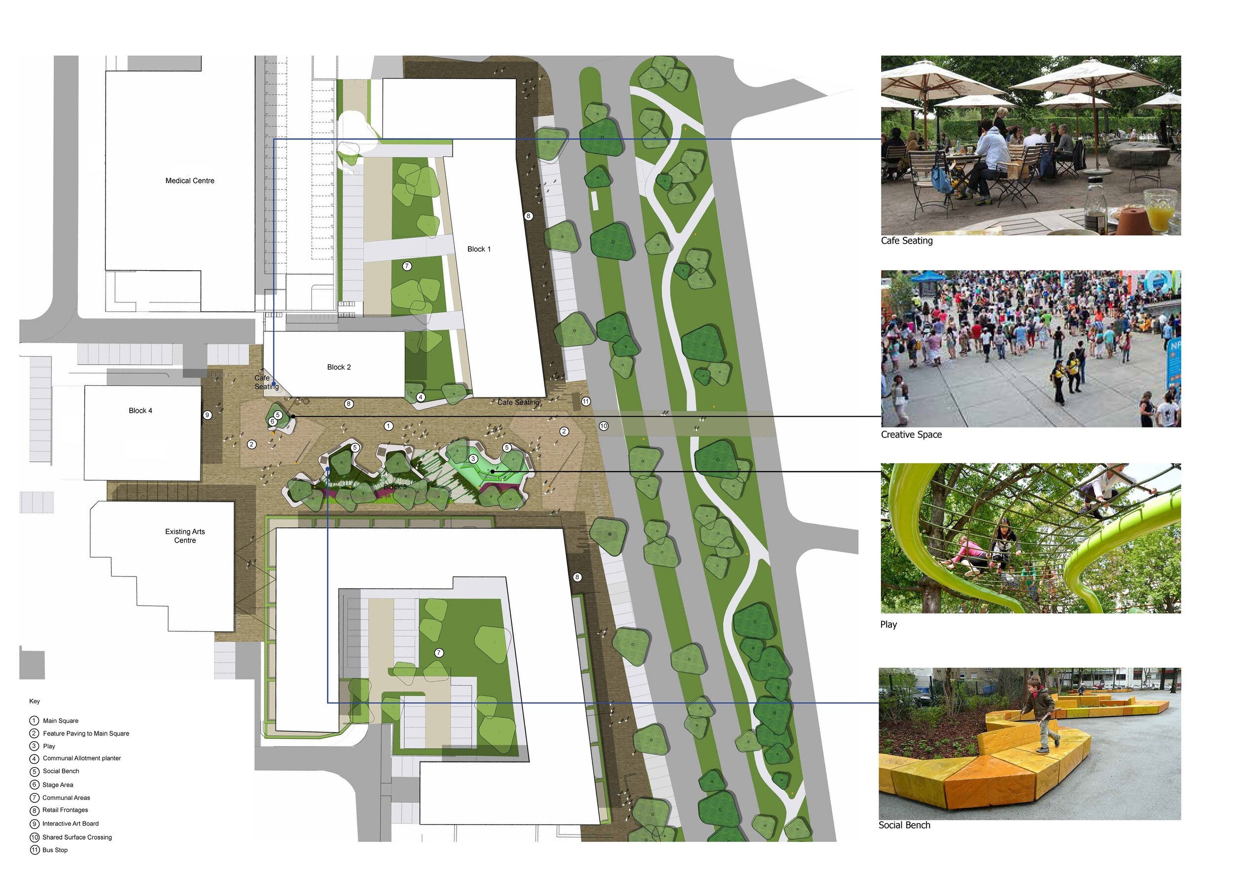
Muirhouse Town Centre, Edinburgh
Project Architect at Barton Willmore for this mixed-use urban regeneration project comprising 148 flats and 14 shops to replace the former shopping arcade and surrounding housing. The development is at the heart of a wider regeneration project in North Edinburgh led by City of Edinburgh Council to deliver over 700 new homes for the community.
The town-centre design is for three new urban blocks with ground floor retail / commercial and residential development above, formed around a car-free civic square.
A community hub & nursery building forms the focal point to the square connecting to the existing and thriving Arts Centre.
Architect: Barton Willmore | Engineer: Bayne Stevenson | Services: Atelier 10
Delivery: Robertson Partnership Homes | Client: City of Edinburgh Council
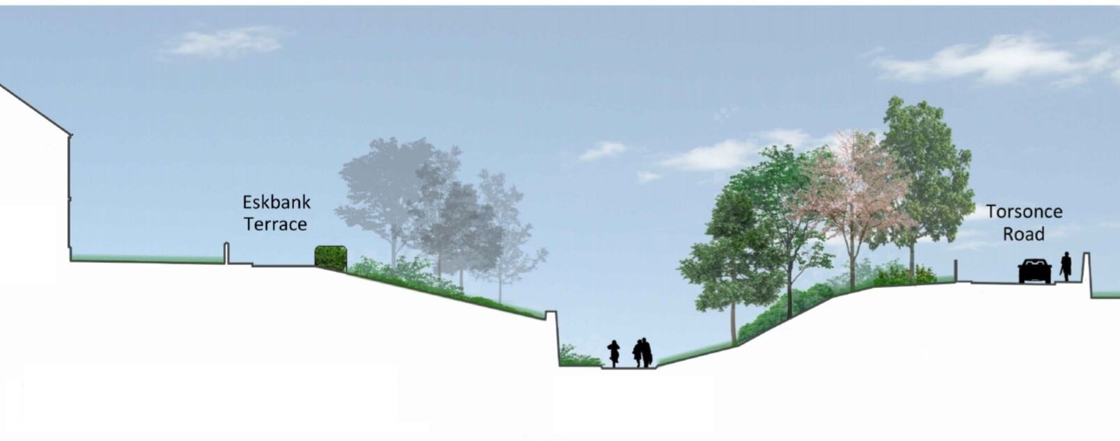
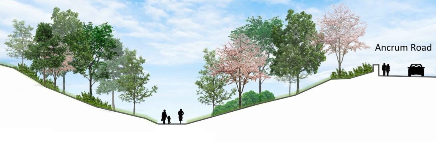
ESKBANK TO DALKEITH PATH
Infrastructure feasibility study supported by SUSTRANS for a multi-user path connecting Eskbank Train Station to King’s Park via an abandoned and neglected former railway line for One Dalkeith, a volunteer-led Community Development Trust.
This project seeks to put back some of the lost amenity (footpaths) caused by the implementation of the Borders Railway line, and provides a vehicle-free route to and from Dalkeith Town Centre whilst enhancing the National Cycle Network Route 196.
The aim is to provide public access to the land: A quiet place to walk, scoot, wheel and cycle completely segregated from traffic.
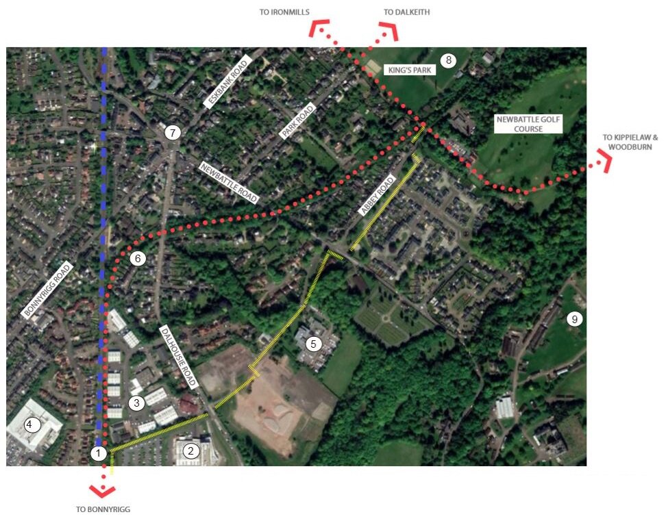
Project Manager: Hardies | Landcape Architect: Barton Willmore | Engineer: David Narro | Ecologist: Brindley Associates
Client: One Dalkeith
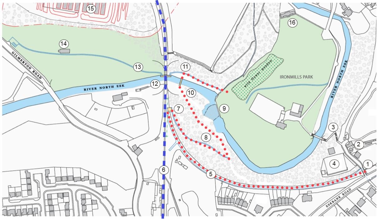
IRONMILLS PARK, DALKEITH
Woodland paths and a new bridge connecting a secluded riverside park to Dalkeith Town Centre.
An extensive network of paths and quiet spaces have been interrupted by the Borders Railway. An existing bridge connecting the town to the park is closed due to landslip and a new route is being explored.
The proposed path meanders through dense woodland before springing over the River Esk, directing users: east to Ironmills or west towards Dobbies via Gilmerton Road. A sloping open field connects through the site of Elginhaugh Fort which was the most northerly bastion of the Roman Empire.